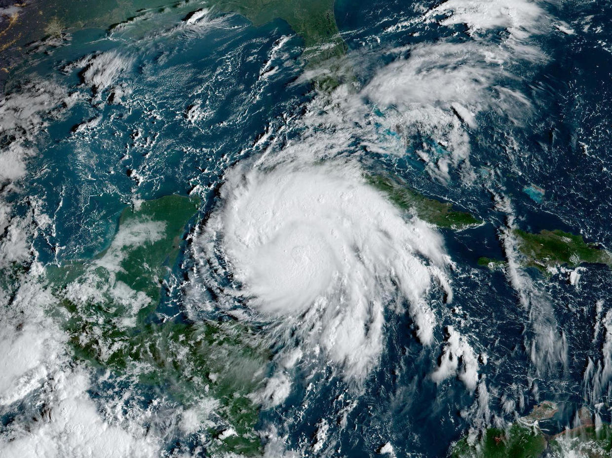
Hurricane Ian moved near the Cayman Islands and closer to western Cuba early Monday on a track to hit Florida as a major hurricane this week. Ian was forecast to intensify rapidly and become a major hurricane as soon as late Monday before becoming an even stronger Category 4 hurricane over warm Gulf of Mexico waters before striking the west central coast of Florida on Wednesday.
At 8 a.m. EDT on Monday, Ian was moving northwest at 14 mph, about 90 miles west-southwest of Grand Cayman, according to the National Hurricane Center. It had maximum sustained winds of 75 mph.
A surge of up to 8 feet of ocean water and 10 inches of rain, with as much as 15 inches in isolated areas, was predicted for the Tampa Bay area. That’s enough water to inundate low-lying coastal communities.
Florida residents were getting ready, lining up for hours in Tampa to collect sandbags and clearing store shelves of bottled water.
Nervous anticipation led to long lines for gas, packed grocery stores and empty shelves, CBS News correspondent Omar Villafranca reports from Clearwater, Florida.
“I tried to get water, but it’s no more. not too much at this moment,” a South Florida woman told CBS station WFOR-TV.
Ian’s impending arrival also prompted NASA to call off its moon-bound Artemis launch for a third time, rescheduling for Sunday.
“A lot of people on the Florida Peninsula and into the Florida Panhandle are at risk and need to be ready to take action quickly,” said Rick Knabb, a hurricane specialist with The Weather Channel, “and the slow motion that we expect from Ian means we could have wind, storm surge and rain-induced flooding.”
A hurricane watch was issued for Florida’s central western coast, including the Tampa Bay area, where Hillsborough County suspended classes through Thursday to prepare schools to serve as shelters for evacuees. Additional watches for more northern areas along the peninsula’s west coast may be issued, National Hurricane Center senior specialist Daniel Brown told The Associated Press.
Gov. Ron DeSantis has declared a state of emergency throughout Florida and urged residents to prepare for the storm to lash large swaths of the state with heavy rains, high winds and rising seas.
“We’re going to keep monitoring the track of this storm. But it really is important to stress the degree of uncertainty that still exists,” DeSantis said at a news conference Sunday, cautioning that “even if you’re not necessarily right in the eye of the path of the storm, there’s going to be pretty broad impacts throughout the state.”
NOAA
Flash and urban flooding is possible in the Florida Keys and Florida Peninsula through midweek, and then heavy rainfall was possible for north Florida, the Florida Panhandle and the southeast United States later this week.
The hurricane center has advised Floridians to have hurricane plans in place and monitor updates of the storm’s evolving path.
President Biden also declared an emergency, authorizing the Department of Homeland Security and the Federal Emergency Management Agency, or FEMA, to coordinate disaster relief and provide assistance to protect lives and property. The president postponed a scheduled Tuesday trip to Florida because of the storm.
In Cuba, authorities suspended classes in Pinar del Rio province and planned evacuations Monday as Ian gained strength on approach to Grand Cayman and the Cuban provinces of Isla de Juventud, Pinar del Rio and Artemisa.
“Cuba is expecting extreme hurricane force winds, also life-threatening storm surge and heavy rainfall,” Brown told the AP.
The hurricane center said Ian should reach far-western Cuba late Monday or early Tuesday, hitting near the country’s most famed tobacco fields. Cuba state media outlet Granma said authorities would begin evacuating people from vulnerable areas early Monday in Pinar del Rio. Classes there have been suspended.
Cayman Islands Premier Wayne Panton said in a video posted Sunday that members of the government and opposition were working together “to ensure that our people are made as safe as possible — the supplies, plywood, in some cases sandbags, are distributed so that they can safely weather this storm … We must prepare for the worst and absolutely pray and hope for the best.”
Share this news on your Fb,Twitter and Whatsapp
Times News Network:Latest News Headlines
Times News Network||Health||New York||USA News||Technology||World News