
CNN
—
The lava spewing from the Mauna Loa volcano in Hawaii continues to flow.
The leading edge remains at around 7,000 feet in elevation, creeping down the mountain at less than a mile an hour.
But the magma has slowed significantly and so far poses little threat to local residents, according to Hawaii emergency management officials. While the lava has already crossed Observatory Road, it could take a week to reach the narrow Daniel K. Inouye Highway roughly three miles away, depending on how the lava reacts on the flatter terrain below.
The volcano erupted Sunday, sending lava toward the northeast. Most of the island’s development is scattered around the coast, so the lava is not currently a threat to people or infrastructure.
The US Geological Survey, which is monitoring the eruption, said in its latest update that the agency is still detecting tremor signals in the volcano’s active fissures. “This indicates that magma is still being supplied, and activity is likely to continue as long as we see this signal.”
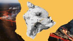
The eruption happened on the Big Island, officially known as Hawaii, the archipelago’s largest. It consists of five volcanoes — four of which are active.
Residents are used to eruptions. The latest is one of more than 130 eruptions in which lava flowed from fissures in the mountain since the 1830s, according to data released by the Hawaii County Civil Defense Agency.
The volcano last erupted in 1984. According to the data, the site has been relatively consistent, erupting 71 times during the 1800s and 68 times during the 1900s.
The historic lava flows have varied in size and direction, depending on the event, over the years:
While the latest eruption hasn’t threatened the island’s infrastructure, it has raised concerns about air quality both for local residents and those living downwind across the Pacific Ocean.
So far, the air quality on the island has remained good, according to the Hawaii Department of Health. Though the department said residents and visitors can expect “vog conditions, ash in the air, and levels of sulfur dioxide to increase and fluctuate in various areas of the state.”
Monitor the air quality in the map of Hawaii below, which will update every three hours.
As local experts monitor the island’s air quality, scientists are keeping an eye on the broader atmosphere after the eruption expelled a large plume of sulfur dioxide that is visible from satellites orbiting the earth.
Note: Volcanic plume progression: Nov. 30-Dec. 5. Darker colors represent a higher Dobson unit, a measure of the densities of sulfur dioxide; Credit: Copernicus Atmosphere Monitoring Service.
The plume is expected to flow across North America over the weekend and into the Atlantic Ocean. That may result in some hazy skies, said Mark Parrington, a senior scientist at Copernicus Atmosphere Monitoring Service, but it’s not likely to reach ground level in the mainland United States.
Share this news on your Fb,Twitter and Whatsapp
Times News Network:Latest News Headlines
Times News Network||Health||New York||USA News||Technology||World News