
Forecasters are growing increasingly concerned about the potential for flooding and structural damage as another atmospheric river storm is slated to hit California this week and drop warm rain atop the state’s near-record snowpack.
The brunt of the warm storm is expected to hit Northern and Central California late Thursday and into Friday, but Southern California will feel some effects as well.
“Friday is pretty much the main day — that’s going to be a washout,” said Mike Wofford, a meteorologist with the National Weather Service in Oxnard. “That could pose some issues at higher elevations where they’ve got a lot of snow and they’ve got rain falling on top of that.”
Up to 8 inches of rain are possible in the coastal foothills from Morro Bay north, while the rest of San Luis Obispo and Santa Barbara Counties could see up to 4 inches. In Ventura County, rainfall amounts of up to 2 inches are possible, while the Los Angeles metropolitan area could get up to 1.5 inches, Wofford said.
Temperatures across the Ventura and L.A. County coasts and valleys will mostly be in the mid-to-upper 60s, with a chance of 70 degrees in the warmest valley locations.
As warm rain melts the snow, it could lead to runoff that swells small streams and rivers and causes localized flooding, the weather service said. The Sisquoc and Salinas rivers could reach the stage at which they will need to be monitored for potential low-lying overflows.
The bulk of the storm “should start to taper off Friday night, and there may be a little bit of rain leftover early Saturday,” in and around Los Angeles, Wofford said. “Most of the weekend at this point looks dry.”
The inbound storm is forming as a northern pressure ridge links with subtropical moisture moving up from Hawaii. Such systems are sometimes referred to as a Pineapple Express and are known to drop heavy precipitation.
It arrives amid an already exceptionally wet winter in California. A series of nine atmospheric river storms pounded the state in early January, causing widespread flooding and contributing to nearly two dozen deaths.
In recent weeks, powerful winter storms dropped heaps of snow across the state, including some elevations as low as 1,000 feet. The Department of Water Resource’s third snow survey of the season, conducted Friday, found that statewide snowpack was 190% of normal — approaching the all-time record set in the winter of 1982-83.
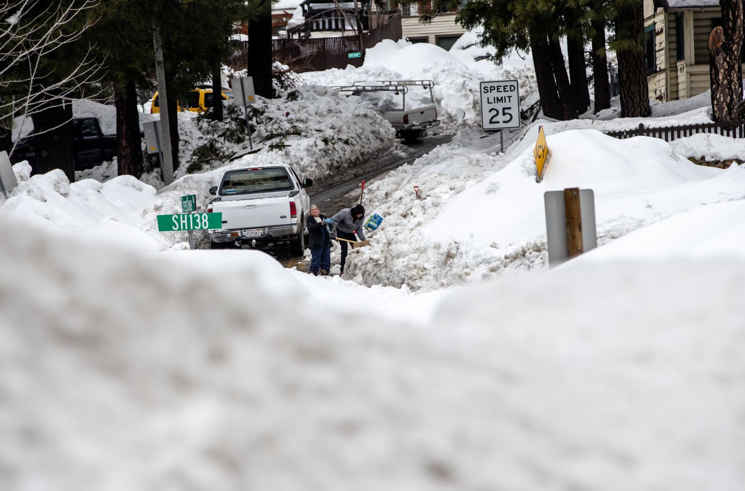
Of particular concern are the San Bernardino County Mountains, where some residents still remain trapped by snow after historic blizzard conditions dropped more than 100 inches of fresh powder in the area.
Officials there are warning that rain could increase the weight of snow atop structures, potentially leading to roof collapse or other issues. Residents and authorities have already reported several roof collapses from mounting snow, including a grocery store providing critical supplies in Crestline last week.
The California Department of Transportation is planning to send crews from the Sacramento area to conduct avalanche inspections along Highway 18 in the San Bernardino County Mountains on Wednesday, the Orange County Register reported. Avalanches have already been reported at high elevations around Mt. Baldy in the nearby San Gabriel Mountains.
Fortunately, rainfall forecasts for the area are trending down a bit, according to Samantha Connolly, a meteorologist with the National Weather Service in San Diego, which covers the San Bernardino area. The mountains there could see anywhere from half and inch to 1 inch of rain, with the bulk of it falling overnight Friday and into Saturday.
“Snow levels are going to be very, very high — generally about 9,000 feet — so it’s all going to come down as rain,” Connolly said. “But it’s not looking particularly heavy at any point, and it’s looking more like a light-to-moderate kind of rain.”
“There could be some minor flows through the roads that have been plowed, but because the snowpack is so deep and the rainfall is not all that heavy, it should be able to, hopefully, absorb it,” she added
Though the rest of the weekend should be dry, the relief may be short-lived as yet another storm system could be heading for California next week.
Wofford said that storm will probably arrive in Southern California on Tuesday morning and will begin to taper on Wednesday, though it could linger for a second day.
Rainfall totals are expected to be fairly similar to the first system, he said, though the forecast may change.
[ad_2]
Share this news on your Fb,Twitter and Whatsapp
Times News Network:Latest News Headlines
Times News Network||Health||New York||USA News||Technology||World News